
Enjoy the Murray River Cliffs Scenic Drive
This self drive was designed and created by the Eastern Hills & Murray Plains Catchement Group Inc.
Download PDF 2mb
Photos from the Mid Murray Self Drive Eco Tour
START – Zero your odometer’s tripmeter
1 – 0 km Mannum Visitor Information Centre
[0.0] [0.0] Leave the Mannum information centre and travel along Randell Street.
At the end of Randell Street veer right onto Adelaide Road
2 – 1.2 km Shearer Factory
The Shearer brothers (Shearer Walk in Mannum) commenced business in Mannum in 1877 as blacksmiths creating farm implements. The factory to the right was first built in the early 1900s for the manufacture of a variety of tillage and harvesting equipment. In 1972 the company was taken over by Horwood Bagshaw.
[3.6] [3.6] Turn left towards Murray Bridge
3 – 5.6 km Rivapak
Rivapak is a purpose built, state-of-the-art onion packing facility located near Mannum. Established in 2000, it provides world class onion grading and packing, ensuring high volumes of consistent top quality onions.
4 – 6.1 km River Murray Forest
On the right a landholder has direct seeded a 30 ha area to native vegetation to store carbon as part of the River Murray Forest initiative. The area was seeded in 2009 to around 15 locally sourced native species of trees and shrubs.
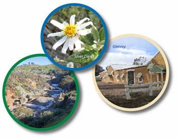
5 – 10.3 km Mannum Waterfalls
In winter and spring when Reedy Creek flows, wild life abounds in this park area. The walk to the waterfalls along a rough track takes around 30 minutes return.
[0.2] [10.5] Return to Cascade Road, turn left from the carpark access track
 11.7 km Mannum Falls top access
The falls can be accessed from the top track. The walk is steep and not well defined. Fit walkers will be rewarded with excellent views across the landscape and the top of the cascade. During the summer months ensure you carry plenty of drinking water. More information about the Mannum Waterfalls.
6 – 15.0 km Prickly Pear
Keep watch on the right for a clump of Prickly Pear, Opuntia robusta. If unchecked this plant can cover vast areas of grazing land rendering it useless. In the 1920s an area the size of Wales infested south western Queensland and was brought under control with the Cactoblastis moth, the larvae of which burrow into the pads of the cactus. In South Australia the plant is controlled with herbicide using a drill and fill method.
[7.3] [17.8] Caution! Continue straight over the Mannum to Palmer Road (bitumen) and onto Fischer Road
[2.2] [20.0] Turn Left onto Wachtel Road
7 – 20.0 km TP Bellchambers Reserve
The vegetation at the rear of this old quarry is home the protected Silver Daisy Bush, Olearia pannosa ssp pannosa. Local volunteers have begun a revegetation and rehabilitation program on the site to protect the plants. It is thought that there may be as few as a thousand plants remaining in the SA Murray Darling Basin. This is the northern most population. TP Bellchambers was a local advocate for conservation in the early 1900s.
[1.9] [21.9] Turn Right onto the Apamurra to Sanderston Road (bitumen)
8 – 22.0 km Old Railway Line
The silos at Apamurra behind you were once served by rail. The railway reserve to the left once went as far north as Sedan. The tracks are still in place south of the silos at Milendella but have never been upgraded from broad gauge. The tracks north of the silos are no longer there, but if the freight line is to be diverted from Murray Bridge to Truro then to the north of Adelaide, this reserve may once again see rail traffic.
9 – 25.5 km Scented Mat Rush
The hillside to the left is covered with tufts of Scented Mat Rush, Lomandra effusa. The collection of grassland plants associated with this species has been declared as critically endangered and programs for its protection are being implemented in this area.
10 – 31.5 km The Pines Reserve
This 25 ha reserve on the right has a native pine, Callitris gracilis, woodland and a smattering of interesting understorey. Bird spotters will be rewarded with a wide variety of sightings in this area.
[9.9] [31.8] Caution! Continue across the Mt Pleasant to Walker Flat Road onto Three Chain Road
11 – 32.7 km Sanderston Cemetery
The reserve that surrounds the cemetery has a plant list of 67 species of natives. The front of the reserve has a large area of Flat Stalk Senna, Senna artemisioides which provides a spectacular yellow display in spring.
12 – 33.7 km Saunders Gorge Sanctuary
Saunders Gorge Sanctuary features 4WD tracks, walks and a restaurant. Overnight stays are possible in one of the cabins or in a beautifully restored stone cottage. Bookings essential.
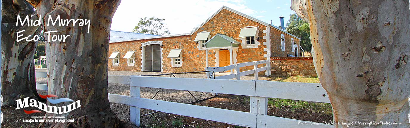
13 – 35 km Glenroy Homestead
The Royal family settled the Sanderston area in the 1800s and built Glenroy Homestead in around 1902. The property is in private ownership but you are invited to enjoy the refurbished buildings from the roadway.
[3.2] [35.0] Turn hard right and return to the main road along Sanderston Road
[2.0] [37.0] Turn left at the Mt Pleasant to Walker Flat Rd
14 – 37 km Sanderston Park
The park at Sanderston carries a memorial to locals who served in war. A time capsule has been placed beneath one of the stones in the park on April 25th 2001 to celebrate 100 years of Federation.
[3.9] [40.9] Turn left onto Sedan Road
15 – 43 km Olives
The olive plantation on the right is one of many in the district. Trees are irrigated using bore water from the local catchment area. The Marne – Saunders Water Allocation Plan, released in 2010, tightly controls the amount of water used. Olive products from this area regularly win state and national awards.
16 – 43.9 km Saunders Creek
This watercourse flows after rains. Its catchment begins just east of Springton in the Hills and passes onto the plains at Saunders Gorge.
17 – 48.1 km Saltbush
The plantings of saltbush on the right serve as wind protection for stock in winter and as a food source in late autumn when pasture is no longer available.
18 – 51 km Marne River
In the 1960s the Marne River flowed for seven months of the year. Water storage for irrigation now only allows a single flow each year. The use of low flow bypasses on dams and the tight regulations introduced in 2010 should see more regular environmental flows in the future.
19 – 51.4 km Cambrai
First called Rhine Villa, Cambrai was renamed during the 1914-18 war. The town has a hotel, area school, Red Cross shop and museum. Food is available from the store and at the Creamery. Public toilets are on the right in Skinner Street behind the hall. The Red Cross Shop is open Wed-Fri + Sun 10-4. (See photos of Cambrai)
[11.5] [52.4] Cambrai. Turn right onto Skinner Street at the OS & P park at the general store
[0.4] [52.8] Turn right at the Lutheran Church on to Marne Valley Road
20 – 58.5 km Turf Farm
The turf farm provides lawns for sporting arenas across the country. Water from bores is tightly controlled under the Marne – Saunders Water Allocation Plan introduced in 2010.
21 – 60.3 km Kongolia
Caution! Slow when passing over the one lane bridge and enjoy the majestic Red Gums, Eucalyptus camaldunensis, that grow in the river channel. When the river floods locals have to use alternative routes on higher ground to access their properties.
22 – 61 km Marne Valley Conservation Park
This area of riverine habitat once supported aboriginals. Their rock art is still barely visible on shelters at the river’s edge.
62.5 km Caution! Take care as you leave the bitumen as the road can be very slippery.
23 – 64.0 km Old Sunshine harvester
Note the remains of an old Sunshine harvester in the paddock to your right.
24 – 66.2 km Spinifex
On the right are clumps of Spinifex, Triodia irritans.
25 – 69.9 km Native Pines
On the left can you spot the difference between the native pines and the planted Aleppo Pines? The introduced Aleppo Pine has lighter needles and large cones.
26 – 72.1 km Black Hill
Black Hill was once a thriving little community. It supported a church, shops and tennis and netball teams. On the left across the swing bridge, the community hall has displays of the town’s history.
27 – 75.2 km Christian Reserve
This reserve was named after John S Christian, who was active in the area last century. In recent years pepper trees have been poisoned to allow recovery of the native vegetation. The reserve is an excellent spot to hear kookaburras calling.
[26.0] [78.8] Turn left into Shell Hill Reserve
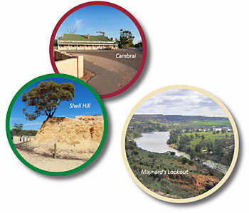 28 – 78.8 km Shell Hill
This reserve has marked walking trails and interpretive information explaining the history of the reserve. It was once the site of a mine which used the fossilised oyster shells to make fertiliser and road building. The trails take the walker through a variety of vegetation associations with spectacular views over the Marne Valley and past an active wombat warren.
[0.9] [79.7] From the Shell Hill entry road, turn left onto Black Hill Road
[0.2] [79.9] Turn Left onto Murraylands Road
[0.4] [80.3] Turn Right onto Seven Sisters Road towards Wongulla
29 – 80.3 km Branched Broomrape
Note the sign on the corner of Seven Sisters Road. You are travelling through the Branched Broomrape, Orobanche ramosa, quarantine zone that extends to the north and south and from the foothills to the other side of the Murray. This parasitic plant has ruined commercial crops overseas and important work is being done to remove it from our landscape. Vehicles and stock can spread the minute seeds and must be washed down when travelling from property to property. There are infected locations where you are instructed not to park on the side of the road. Keep an eye open for the brown signs.
[1.2] [81.5] Turn left into onto Peters Rd (Wongulla Rd)
[4.8] [86.3] Turn left to Wongulla
[9.1] [86.4] Turn right towards the boat ramp
30 – 86.8 km Wongulla Boat Ramp
Just to the north of the boat ramp the Marne River finally empties into the Murray. Toilets are available at the boat ramp however there are no shops at this location.
[0.4] [86.8] Leave the Wongulla Boat Ramp
[0.5] [87.3] Turn left onto Cliff View Drive
31 – 93.1 km Maynard’s Lookout
The spectacular views of the cliffs on the opposite side of the Murray reach their crescendo at Maynard’s Lookout, where unparalleled views over cliffs, river and wetlands can be taken in.
32 – 94.8 km Walker Flat General Store
Food and fuel is available.
[9.0] [96.3] Turn left towards Walker Flat
[0.8] [97.5] Arrive at the Walker Flat river front
33 – 97.5 km Walker Flat
Refreshments are available at the deli and public toilets can be found adjacent to the ferry queue. Enjoy a meal on the lawns and watch the ferry ply back and forth while listening to the cockatoos in the gums.
34 – 99.1 km Black Box
Leaving the riverfront area take in the rough barked River Box trees, Eucalyptus largiflorens, that form the second line of trees above the riverfront. This indicates a line of high water in past years which enabled the trees to germinate.
[3.4] [100.4] Veer right and stay on the main road to Mannum
35 – 105.5 km Whipstick mallee
This is the name given to the spindly stemmed trees along either side of the road. They have grown this way because at some time in the past they have been cut at the base for firewood and have resprouted in this multi-stemmed form. Occasionally you will see a single stemmed tree that was missed in the original cropping process.
[13.4] [113.8] Turn right at the T-junction
36 – 117.2 km Greenings Landing
Private property
119.9 km Saunders Creek
Saunders Creek enters the Murray here
37 – 123.9 km Noa No Landing (500m return)
This is the site where the Mary Ann, the very first steam powered riverboat was launched by William Randell in 1853 on the Murray-Darling River system. The Mary Ann has given its name to the riverfront reserve at Mannum. (William Randell walk in Mannum)
38 – 128.0 km Long Gully Creek
An information bay has an interesting display.
39 – 128.8 km Herman Gass Reserve (Lions Park)
This wetland has a wide variety of wetland birds and frogs. A boardwalk takes you into the wetland.
40 – 129.0 km Mannum Caravan Park
1 – 129.3 km Mannum Visitor Information Centre
We trust you have enjoyed your Mid Murray Self Drive Eco Tour
Enjoy the Murray River Cliffs Scenic Drive
For more information on the Murraylands on Discover Murray River or VisitMurraylands.com
Work at Shell Hill Reserve and TP Bellchambers Reserve has been undertaken by local community group volunteers and with the assistance of the Mid Murray Council.
The Eastern Hills & Murray Plains Catchment Group together with the Mid Murray Local Action Planning Association have sourced funds from state government to pay for materials.
Where possible local businesses and council have been used to prepare interpretive signage and
build structures.
Eastern Hills & Murray Plains Catchment Group Inc
www.ehmpcg.org.au
Mid Murray Local Action Planning Inc
www.midmurraylap.org.au